
Best Drones for Construction Site Mapping in 2026: 5 Picks That Actually Save Survey Time
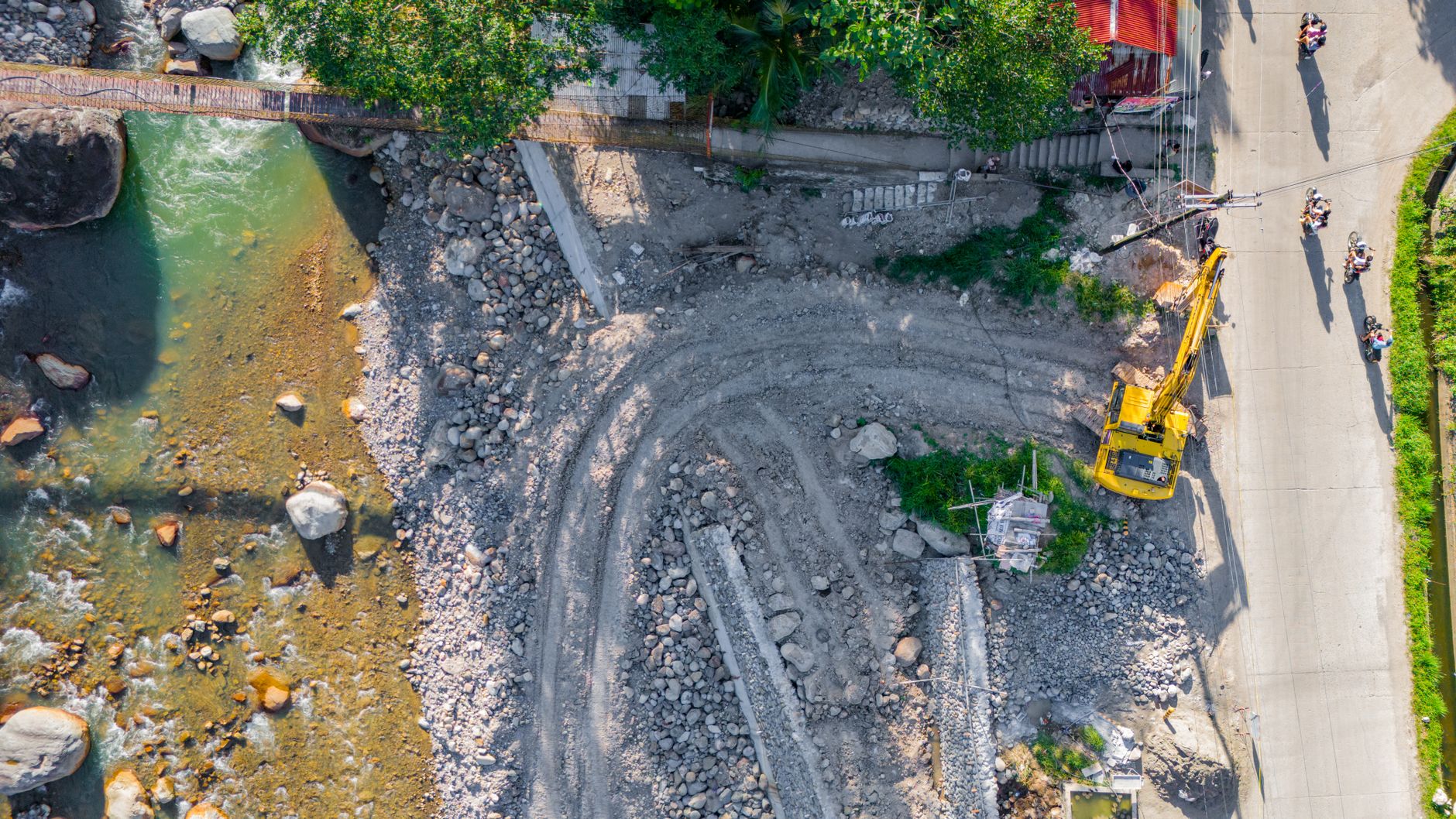
The construction industry is in the middle of a data revolution. With labor shortages squeezing timelines and BIM workflows becoming standard on mid-size projects, contractors are ditching traditional ground surveys for autonomous aerial mapping. What used to take a three-person crew two days now takes a single operator 45 minutes — and the best drones for construction site mapping are the reason why.
But here’s the problem: most “best drone” lists are written by people who’ve never stepped onto an active job site. They recommend camera drones that can’t handle dust, wind, or the brutal accuracy requirements of volumetric calculations. This guide is different. We’ve evaluated these UAVs based on what actually matters when you’re mapping a 50-acre development: RTK precision, waypoint mission reliability, and seamless integration with software like Pix4D, DroneDeploy, and Propeller.
Whether you’re a project manager tracking earthwork progress or a surveyor bidding on topographic contracts, these five platforms deliver survey-grade results without the five-figure price tag of traditional equipment.
Why Construction Mapping Demands More Than a Camera Drone
Consumer drones are great for Instagram shots. Construction mapping is a different beast entirely. You’re not just taking pretty pictures — you’re generating orthomosaics, digital terrain models, and point clouds that engineers will use to make million-dollar decisions.
Accuracy is non-negotiable. For cut-and-fill calculations, you need horizontal accuracy within 2-3 cm and vertical accuracy within 5 cm. That’s impossible with standard GPS. You need RTK (Real-Time Kinematic) or PPK (Post-Processed Kinematic) positioning, which uses a base station or network corrections to pin the drone’s location to centimeter-level precision.
Wind and dust are constant enemies. Job sites are harsh. A drone that struggles in 15 mph winds will sit in its case half the year. Look for IP ratings, robust motor design, and the ability to hold position in gusty conditions without drifting off your flight plan.
Software compatibility saves hours. The best hardware is useless if it doesn’t play nice with your processing pipeline. Native support for DroneDeploy, Pix4Dmatic, or Bentley ContextCapture means you spend less time converting files and more time analyzing data.
What to Look for in a Construction Mapping Drone
Before we dive into specific models, here’s your checklist for evaluating any UAV for site work:
- RTK/PPK module: Built-in or add-on? Hot-swappable? Does it support NTRIP network corrections?
- Mechanical shutter: Eliminates rolling shutter distortion on fast flights — critical for photogrammetry
- Flight time: Minimum 35 minutes per battery; 45+ is ideal for large sites
- Obstacle avoidance: Six-direction sensing is worth the premium when flying near cranes and scaffolding
- Payload flexibility: Can it carry a thermal sensor or LiDAR module for future expansion?
- Regulatory compliance: Remote ID built-in, and check if it qualifies for FAA Category 1-3 operations over people
Don’t overlook the controller ecosystem either. A bright, sunlight-readable screen and the ability to import KML boundary files directly will streamline your workflow significantly.
The 5 Best Drones for Construction Site Mapping in 2026
1. DJI Matrice 4E — The Enterprise Workhorse
The Matrice 4E has become the default choice for mid-to-large contractors, and for good reason. Its integrated RTK module delivers 2 cm horizontal accuracy without external base stations when connected to an NTRIP network. The 4/3-inch CMOS sensor with mechanical shutter captures 20 MP stills, and the 45-minute flight time covers roughly 200 acres per battery at 120 m AGL.
What sets it apart is the smart oblique capture mode, which automatically tilts the camera to capture building facades — essential for vertical construction progress tracking. Pair it with DJI Terra for rapid 2D/3D reconstruction, or export directly to third-party platforms.
Best for: General contractors needing one drone for progress photos, volumetrics, and BIM verification.
2. Autel EVO Max 4T — The DJI Alternative
If your company has DJI restrictions or you simply want a non-Chinese option, the EVO Max 4T is the most capable alternative. Its RTK module achieves 1 cm + 1 ppm accuracy, and the 50 MP wide camera with 1/1.28-inch sensor performs surprisingly well in low-light morning flights.
The standout feature is its autonomy. Autel’s A-Mesh networking lets you coordinate multiple drones for large-area mapping, and the IP43 rating means it shrugs off light rain and dust that would ground lesser aircraft. Battery life is rated at 42 minutes, though real-world mapping missions typically yield 35-38 minutes.
Best for: Government-adjacent projects and companies with DJI procurement bans.
3. WingtraOne Gen II — The Fixed-Wing Specialist
For sites exceeding 500 acres, multirotors become inefficient. The WingtraOne Gen II is a VTOL fixed-wing that takes off vertically like a helicopter, then transitions to forward flight for efficient coverage. It maps 1,000+ acres in a single 59-minute flight at 3 cm/px GSD.
The RX1R II payload with 61 MP full-frame sensor captures incredible detail, and PPK processing delivers 1 cm absolute accuracy. The trade-off is cost — expect to invest $25,000+ with software — and the learning curve is steeper than a quadcopter. But for mining, quarry, and large infrastructure projects, the ROI is undeniable.
Best for: Large-scale earthworks, mining operations, and linear infrastructure corridors.
4. DJI Mavic 3 Enterprise — The Budget RTK Option
Not every project needs a $15,000 Matrice. The Mavic 3 Enterprise (M3E) packs RTK, a mechanical shutter, and 45-minute flight time into a portable package under $5,000. The 20 MP Four Thirds sensor is identical to the Matrice 4E’s, and it supports the same mapping missions through DJI Pilot 2.
The compromise is durability. The M3E lacks the Matrice’s weather sealing and hot-swappable batteries. But for small-to-mid-size sites, weekly progress mapping, or as a backup unit, it’s unbeatable value. Many survey firms run three M3Es for the cost of one Matrice, multiplying their daily coverage.
Best for: Small contractors, survey startups, and as a secondary/backup aircraft.
5. senseFly eBee X — The Lightweight Mapper
Weighing under 2 kg, the eBee X avoids some regulatory headaches in congested airspace and is easier to transport to remote sites. Its endurance reaches 90 minutes with the optional endurance battery, and the S.O.D.A. 3D camera captures nadir and oblique imagery simultaneously.
The eBee’s emotion3 software suite is purpose-built for surveying, with direct export to CAD formats. Accuracy with PPK is 1.5 cm horizontal, and the foam airframe survives rough landings that would crack carbon fiber. It’s not fast to deploy — plan 10 minutes for assembly and launch — but for corridor mapping and large-area topo work, it’s a proven platform.
Best for: Surveyors needing maximum flight time in a portable, regulation-friendly package.
Mapping Software: The Other Half of the Equation
Your drone is only as good as your processing pipeline. Here’s what professionals are using in 2026:
- DroneDeploy: Best all-around for construction. Progress photos, volumetrics, and BIM overlay in one platform. Starts at $329/month.
- Pix4Dmatic: Handles massive datasets (10,000+ images) and corridor mapping. Perpetual license available.
- Propeller Aero: Purpose-built for earthworks. DirtMate integration tracks machine data alongside drone surveys.
- DJI Terra: Fast processing for DJI drones. Free for basic 2D maps; paid for 3D and LiDAR.
Pro tip: Always fly with 80% front overlap and 70% side overlap for construction sites. The extra images cost you 5 minutes of flight time but prevent processing failures that waste entire days.
Pro Tips for Accurate Construction Surveys
Use ground control points (GCPs) even with RTK. RTK gives you relative accuracy; GCPs tie your model to the site coordinate system. Place at least 5 GCPs around the perimeter and one in the center. AeroPoints or painted targets work well.
Fly at consistent times. Morning flights (8-10 AM) minimize shadows that confuse photogrammetry algorithms. Avoid midday when harsh shadows create data gaps.
Check your GSD. For volumetric calculations, keep ground sample distance under 3 cm/px. That typically means flying at 80-100 m AGL with a 20 MP sensor.
Document everything. Log weather conditions, battery cycles, and any site changes. This metadata is invaluable when comparing surveys month-over-month.
Conclusion: Choosing the Right Mapping Drone for Your Fleet
The best drones for construction site mapping in 2026 share common DNA: RTK precision, mechanical shutters, and software ecosystems that turn raw images into actionable data. For most contractors, the DJI Matrice 4E or Mavic 3 Enterprise will handle 90% of mapping tasks. Large-area specialists should evaluate the WingtraOne, while DJI-restricted operations have a capable alternative in the Autel EVO Max 4T.
Start with your typical site size and accuracy requirements, then factor in software costs — a $5,000 drone with a $4,000/year software subscription is a $25,000 commitment over five years. Whatever you choose, the ROI is clear: contractors using drone mapping report 60% faster survey turnaround and 30% fewer disputes over earthwork quantities. In an industry where margins are tight and timelines tighter, that’s not just an advantage — it’s survival.